
CORRIDOR
As a Conservation Cartographer for Archbold Biological Station, I provided cartographic support to the Florida Wildlife Corridor Campaign.
CORRIDOR COVERAGE
I worked with journalists to create custom maps for digital and print articles that share the story of the Florida Wildlife Corridor.


A QUICK GUIDE TO THE CORRIDOR
In collaboration with National Geographic photojournalist and science communicator Jen Guyton, I created this infographic as an introduction to the Corridor.


CELEBRATING PROGRESS
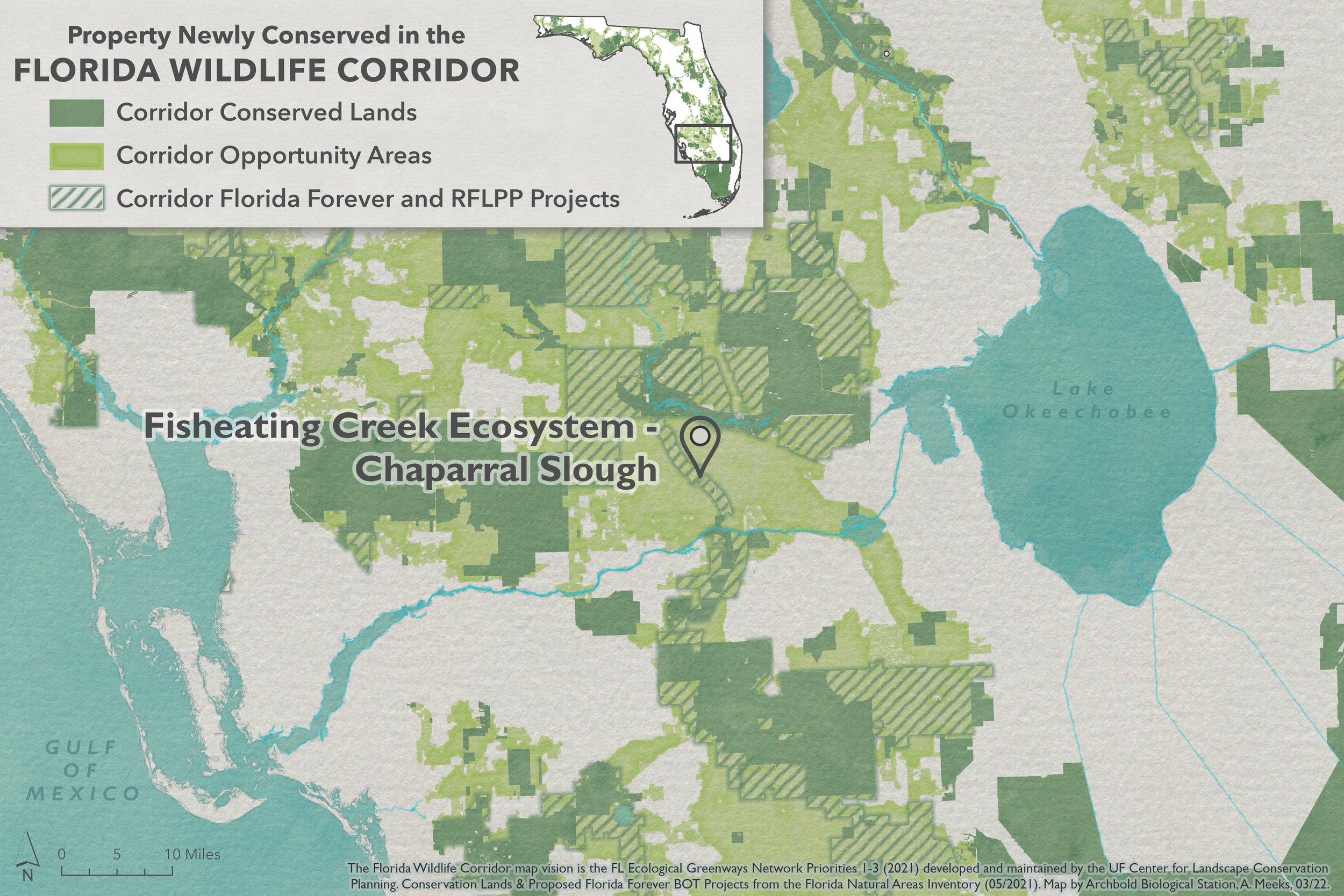
The following are examples of maps created to celebrate land acquisition by the State of Florida in the Corridor. They were featured in social media posts along with photography from National Geographic photographer Carlton Ward, Jr. and his team at Wildpath.


I created this story with my colleagues Katie Bryden and Lauren Yoho from Wildpath. It provides a brief introduction to the Florida Wildlife Corridor and features an interactive map and tour of land acquisition progress in the Corridor by the State of Florida.

WHERE THE BEARS GO
I created this story with my colleague, wildlife biologist Joseph Guthrie. It tells the story of a young Florida black bear and how he influenced the future of conservation in Florida. All map animations were done in ArcGIS Pro. See StoryMap for full credits.

Working with my colleague Joe Guthrie again, I took the dynamic story of Florida Black Bear M34 and created a static map that captures the essence of his journey. I created the map in ArcGIS Pro and Adobe Illustrator.
WHERE THE PANTHERS ARE
I created this map for ZooTampa’s new Florida Wilds expansion so visitors could understand how critical the Florida Wildlife Corridor is for Florida’s remaining panther population. I designed the map to adhere to their brand guidelines while also being color accessible. I used ArcGIS Pro and Adobe Illustrator to create the map. The image on the right shows the map in its new home at ZooTampa.


PUTTING THE PIECES TOGETHER
Protecting the Florida Wildlife Corridor happens one piece at a time. I designed this map to be made into a puzzle and given as a thank you gift to our campaign partners and supporters to reflect our journey conserving the Florida Wildlife Corridor. The map was created in ArcGIS Pro and finished in Illustrator using photos by Carlton Ward, Jr.

